← All articles
Ring 4 Isn't Steep. It Just Never Stops.
Oslo's classic forest loop, and how to ride it
Oslo's classic forest loop, and how to ride it
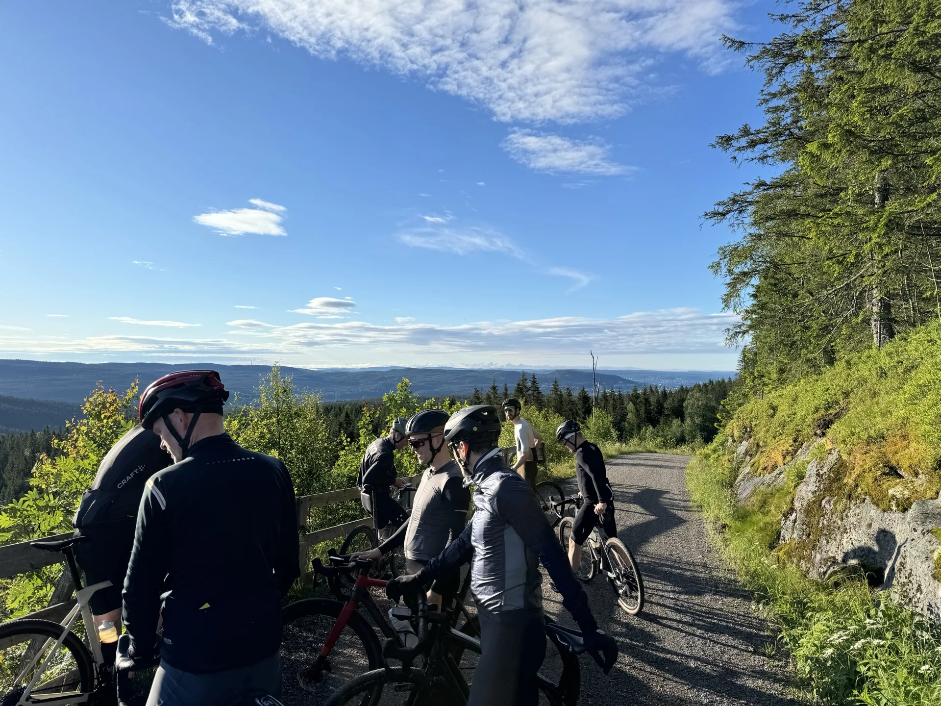
Ring 4 is the ride Oslo cyclists measure their season by. Fifty-odd kilometres of forest gravel north of the city, a thousand metres of climbing, and a cabin about halfway round that sells waffles. People here have been riding it for generations, and most visitors have never heard of it.
It is also widely underestimated, including by people who have already done it.
Oslo's ring roads are numbered outwards from the centre. Ring 1 threads through the middle of town, Ring 2 sits around the inner districts, and Ring 3 is the big arterial that swings around the outer suburbs.
There is no Ring 4 on any road map, because it is not a road. It is the name local cyclists gave to the loop that runs further out still: through the forest, on gravel, reachable only by bike or on foot. The joke is older than most of the bikes riding it, and it has stuck because it describes the thing precisely. Ring 4 really is the next ring out. It just happens to have trees instead of traffic.
Depending on which connectors you take, Ring 4 runs somewhere between 50 and 55 kilometres with around 1 000 metres of climbing. There is no single official line, which is why you will see different numbers quoted, including on this site.
Those two figures together tend to worry people, and then the ride itself confuses them, because almost nothing about it feels like a climb. The long haul out of Maridalen gains roughly 250 metres over something like 13 kilometres. That is an average gradient under two per cent. On paper it is nothing. In practice you are climbing for the better part of an hour without ever once being able to say you are climbing.
Two things follow from that, and they are the reason this loop humbles people.
The high point, a little over 440 metres, comes after halfway. Most riders pace a loop as though the summit sits in the middle, and on Ring 4 it does not. And there is a final rise of about 100 metres at around forty kilometres in, exactly where everyone has decided the climbing is behind them and started thinking about dinner.
None of this makes it a hard ride. It makes it a long one that needs rationing. Recreational fitness is plenty if you treat it as a four to five hour day rather than a morning spin.
Being a loop, Ring 4 has no official beginning. Join it wherever you like and finish where you started.
Maridalen is a good entry point from the city side. It is flat and scenic along the lake, and it puts the long climb ahead of you while your legs are still fresh. The easiest way to reach it is Kjelsås, served by two tram lines, which is also one of our free rental pickup points.
You can also ride it the other way round, starting in Sørkedalen. From our Huseby pickup that means going up Mærradalen to Bogstad first, then into Sørkedalen and onto the loop from the west. Reversed, the character of the day changes completely: the long drag becomes a long descent, and the climbing is chopped into shorter, steeper pieces earlier on. Riders who find the Maridalen haul monotonous often prefer it this way.
Around halfway, Kikutstua appears out of the trees. It is one of the old Nordmarka cabins, it serves coffee and waffles, and for a significant number of Oslo riders it is the actual point of the exercise.
It is not the only option. Several other cabins sit within a short detour of the loop, so if Kikutstua is busy, or you want to stretch the day out, there is somewhere else within a few kilometres. Stop too long anywhere and the second half feels harder than it should. Skip the cabins entirely and you have missed the part of Ring 4 that people actually talk about afterwards.
A gravel bike is the right tool, and it is what we rent. The surface is hard-packed forest road for almost the whole loop, occasionally loose, and never technical. Road tyres will be nervous on the descents, and a mountain bike is more machine than the terrain asks for. A city hybrid will make the long drag miserable.
Our gravel bikes start at NOK 899 for the first day and cost less for every day after that, with a helmet, pump, spare inner tube and multi-tool included. Collection at Kjelsås puts you on the route straight away, and it is one of the four pickup points included in the price.
If the climbing is the part that puts you off, an e-bike is a genuinely reasonable choice, and not only for people who are unfit. A thousand metres of shallow, unbroken climbing is precisely the profile that assistance flattens. It turns Ring 4 from a day you plan around into a ride you can do before dinner.
Ring 4 rides from when the snow clears in spring until the first snow lands in autumn. The window shifts every year, and the higher middle section holds snow noticeably longer than the valley floor, so early-season attempts can meet slush at 400 metres while Maridalen is dry.
In between, it changes character rather than quality. Spring is loud with meltwater. High summer is dusty and busy near the trailheads. Autumn packs the surface down firm and turns the birch yellow. Once the snow settles, the same forest roads become ski trails, and they belong to the skiers.
The forest is not signposted for visitors, and Ring 4 is not marked as a route. Junction after junction looks identical, and phone signal is patchy in the middle. Navigating it by memory on a first attempt is how people end up riding 70 kilometres instead of 52.
So take the file. Ours is free, needs no account, and works with Garmin, Wahoo, Komoot, Strava or anything else that reads GPX.
Download the Ring 4 GPX (from Kjelsås)
Our guided Nordmarka Forest tour follows the classic loop with a local guide, a waffle stop at Kikutstua and the route-finding taken care of.
Nordmarka Forest tourOslo's ring roads are numbered outwards from the city centre: Ring 1 in the middle, Ring 3 furthest out. Ring 4 does not appear on any road map, because it is not a road. It is the name local cyclists gave the loop that runs further out still, through the Nordmarka forest, on gravel you can only reach by bike or on foot. The joke has outlasted most of the people who made it.
Somewhere between 50 and 55 km depending on which connectors you take, with roughly 1 000 metres of climbing. The distance varies because there is no single official line: riders join and leave the loop at different points. Allow four to five hours at a relaxed pace with a stop.
It is long rather than steep. The main climb gains around 250 metres over something like 13 km, which is an average gradient under two per cent, and nothing on the loop is technically hard on a gravel bike. What catches people out is that the climbing barely stops, and the high point comes after halfway. Recreational fitness is enough if you pace it.
There is no official start, and riders join it in different places. Maridalen is a good entry point from the city side, most easily reached at Kjelsås, which two tram lines serve. You can also ride it the other way round by starting in Sørkedalen, which from Huseby means going up Mærradalen to Bogstad first. Since it is a loop, you can join it wherever suits you and finish where you began.
From when the snow clears in spring until the first snow lands in autumn. The exact window moves every year, and the higher middle section holds snow for longer than the valley floor. Outside that, the same forest roads become ski trails and should be left to the skiers.
Yes. We publish a free GPX of the Kjelsås version on this page. There is no account needed and no subscription, and the file works with Garmin, Wahoo, Komoot, Strava and anything else that reads GPX.